Publisher:
Bonnie King
CONTACT:
Newsroom@Salem-news.com
Advertising:
Adsales@Salem-news.com

~Truth~
~Justice~
~Peace~
TJP
Nov-29-2015 21:15

 TweetFollow @OregonNews
Light Snow Expected on Oregon's Valley Floors
Salem-News.com WeatherAmounts inland are expected to range from a trace to a few hundredths of an inch at most.
 |
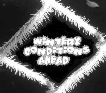
(SALEM, Ore.) - Light mixed winter precipitation is possible over much of southwest Washington and northwest Oregon Monday and Monday evening, according to a Special Weather Statement from the NOAA.
A very weak front moving onto the coast Monday morning and inland late Monday morning and afternoon and evening will encounter a cold dry air mass in place over much of northwest Oregon and southwest Washington.
Some of the moisture with the system will tend to evaporate before reaching the ground, but there is increasing confidence that some light snow, sleet, or freezing rain will fall especially in the colder, sheltered valleys of the coast range and the Cascade foothills, in the inland valleys including the Willamette Valley, the Columbia River Gorge, and upper Hood River Valley.
The moisture will reach the coast and Coast Range first Monday morning, but any winter precipitation at the coast will be brief.
The winter precipitation is expected to reach the coastal valleys Monday morning, and possibly even into the south and central Willamette Valley before noon and before temperatures have a chance to rise above freezing. The moisture will spread across the remainder of northwest Oregon and southwest Washington Monday afternoon, but not expected to reach the Hood River area until late afternoon or evening, where a little light snow is the most likely outcome.
Once temperatures inland slowly rise to above freezing Monday afternoon, the threat of freezing rain will diminish and the main threat will be a rain or snow mix as highs Monday may stay in the 30s.
Amounts inland are expected to range from a trace to a few hundredths of an inch at most. These limited amounts will likely limit the ultimate impacts.
Nevertheless, those traveling in Northwest Oregon and Southwest Washington should use extra caution and be prepared for the possibility of some wintry conditions.
Source: NOAA-NWS-ALERTS-OR1253CCE59C14.SpecialWeatherStatement.1253CCF45470OR.PQRSPSPQR.137f936d3e4e43dd73551de84424ee96 from w-nws.webmaster@noaa.gov
 |
Articles for November 29, 2015 | Articles for November 30, 2015
Quick Links
DINING
Willamette UniversityGoudy Commons Cafe
Dine on the Queen
Willamette Queen Sternwheeler
MUST SEE SALEM
Oregon Capitol ToursCapitol History Gateway
Willamette River Ride
Willamette Queen Sternwheeler
Historic Home Tours:
Deepwood Museum
The Bush House
Gaiety Hollow Garden
AUCTIONS - APPRAISALS
Auction Masters & AppraisalsCONSTRUCTION SERVICES
Roofing and ContractingSheridan, Ore.
ONLINE SHOPPING
Special Occasion DressesAdvertise with Salem-News
Contact:AdSales@Salem-News.com

googlec507860f6901db00.html


Terms of Service | Privacy Policy
All comments and messages are approved by people and self promotional links or unacceptable comments are denied.
[Return to Top]
©2025 Salem-News.com. All opinions expressed in this article are those of the author and do not necessarily reflect those of Salem-News.com.