
Publisher:
Bonnie King
CONTACT:
Newsroom@Salem-news.com
Advertising:
Adsales@Salem-news.com

~Truth~
~Justice~
~Peace~
TJP
May-18-2009 08:09

 TweetFollow @OregonNews
A Battle Ax of a Trail in Oregon's Mountain Wilderness
Gerrit Roelof Salem-News.com OUTDOORSWe’ll be back to this trail again, probably later in the year when the snows are much higher. Battle Ax Mountain has not defeated us yet!
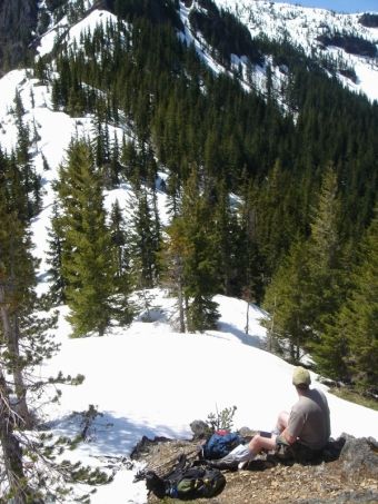 All photos by Adam Bello |
(SALEM, Ore.) - Usually when I plan an outdoor adventure, the weather gods are not smiling. Well, I must have paid my dues, because I chose this past weekend to hike some new territory. 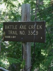
With spectacularly blue skies and ridiculously warm forecasted temperatures, my two buddies and I took off from Salem early Friday morning.
Our destination was Beachie Saddle (4,314‘), and then hopefully Battle Ax Mountain (5,558’) by way of Jawbone Flats.
The map told us that we were looking at about a 2,400’ elevation gain from the gate to Beachie Saddle, and about 7-9 miles of trail, depending on which trail map you used. From Salem we drove east on Hwy 22 to Gates Hill Rd (the only major intersection in Gates). There we hung a left and climbed straight up, and then straight down.
We then turned right onto Little North Fork Rd and followed it past the end of pavement, to the gate at the trailhead (about an hour drive from Salem).
The elevation here is 1,950’. This can be a relatively popular trailhead (there were only 3 cars when we got there on Friday, but over 30 when we left on Sunday) when the weather is good.
The walk from the gate to Jawbone Flats and the Opal Creek Ancient Forest Center is a mostly flat 3 mile road along the Little North Fork River. Only vehicles associated with the Forest Center are allowed past the gate, the rest of us use two feet.
After a break at Jawbone Flats (which is another destination to be featured in a future article) we began climbing along Battle Ax Creek. There are many old mines and interesting artifacts in this area, that have a great deal of historic value.
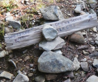 We warned you that this was a rough trail. Even the signs are primitive! |
Although they looked very attractive, we made sure to leave them where we found them so others could enjoy them as well.
This trail is actually an old logging road that connected Jawbone Flats to Elk Lake many years ago. Since it now lies in two different wilderness areas (Opal Creek and Bull of the Woods) the forest has taken it back over. There are still the remains of the old metal gate about 1.5 miles up from Jawbone Flats.
The sign next to it says “Shiny Rock Mining Company, No Vehicles Allowed”. By the time we reached this gate the firs, cedars, rhododendron and trillium had done their best to disguise the old road bed.
From the gate we climbed another mile or so, and gained about 1,000’ in elevation. We were forced to set up camp at about 3,300’ because we were now into the edge of the snow, and campsites were becoming few and far between.
The next morning we awoke to the sunlight creeping down the canyon walls until it poked it’s head over Battle Ax and warmed us up for the days adventure.
It didn’t take us very long to strap on our snowshoes after leaving camp, as the snow quickly deepened. This is not an oft-used trail, and the conditions make that clear.
There are many blow downs and washouts, which are tough enough in boots, but are an entirely different story with 3’ of snow on the ground and awkward flippers on your feet!
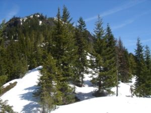
The higher we got, the deeper the snow became. As we approached Beachie Saddle, the snows were so deep that they almost completely obliterated the old road bed. Side-hilling in snowshoes is not for the faint of heart, this is very steep country.
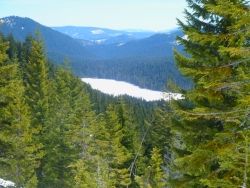
After a few tricky sections, we broke out onto the top of the Saddle. The views here were spectacular, as the attached photos will attest. I was surprised to see that Elk Lake is still completely frozen and snow-covered.
After lunch on a rock outcropping on the shoulders of Battle Ax, we determined that continuing up the steep slopes of the mountain with this much snow was not quite worth the risk.
There was a solid 6-8’ of snow where we were, and the peak was another 1,000’ up. After a few more photos, and a brief glimpse of Mt. Jefferson around the side of a ridge, it was time to head back.
We made it back to camp in record time (apparently it’s much easier to go down than to climb up), and enjoyed a relaxing second night in camp.
Sunday morning came, and we made our way leisurely back out to the gate. This is a “Moderate to Difficult” trail by most accounts. The snow didn’t make it any easier.
My body is reminding me how old I really am after that hike, and it would not be recommended for anyone who is not in decent shape with decent equipment. Without snowshoes and gaiters, we would not have been able to get much higher than our campsite.
With that said, the rewards of traveling a little used trail can be great, if you take the time to look around. We’ll be back to this trail again, probably later in the year when the snows are much higher. Battle Ax Mountain has not defeated us yet!
 When time allows, Gerrit and his family make the break to the Detroit Lake area and other parts of Oregon where hunting and fishing are the order of the day. Gerrit has a way with words that is drawn from both education and life experience. While Gerrit has a full time career in law enforcement and firefighting before that, he has also taken the time to polish his natural skills at delivering written and visual information. He used to have an outdoor column in the South Salem Post. He has also written regular articles for Oregon Fishing & Hunting News and ESPN.com. Gerrit's experience in life is both awe-inspiring and honorable. Gerrit is likable, uniquely qualified, energetic and down to earth. He helps fill the void when it comes to articles about all of the amazing things Oregon has to offer those who have a connection with nature; be it through hiking, fishing, photography, hunting, or so many other outdoor activities here.
Articles for May 17, 2009 | Articles for May 18, 2009 | Articles for May 19, 2009
Quick Links
DINING
Willamette UniversityGoudy Commons Cafe
Dine on the Queen
Willamette Queen Sternwheeler
MUST SEE SALEM
Oregon Capitol ToursCapitol History Gateway
Willamette River Ride
Willamette Queen Sternwheeler
Historic Home Tours:
Deepwood Museum
The Bush House
Gaiety Hollow Garden
AUCTIONS - APPRAISALS
Auction Masters & AppraisalsCONSTRUCTION SERVICES
Roofing and ContractingSheridan, Ore.
ONLINE SHOPPING
Special Occasion DressesAdvertise with Salem-News
Contact:AdSales@Salem-News.com

googlec507860f6901db00.html


Terms of Service | Privacy Policy
All comments and messages are approved by people and self promotional links or unacceptable comments are denied.
Running Bear September 23, 2012 9:22 am (Pacific time)
Try Battle Axe from Elk Lake side. Much easier.
bob April 11, 2010 12:58 pm (Pacific time)
this is bad what are cookies
Roger May 27, 2009 1:14 pm (Pacific time)
Thanks Gerrit- I was thinking of taking a bunch of scouts across Beachie Saddle in a few weeks. I think now that I will wait until the snow is down a little...
Allan Erickson May 20, 2009 1:50 pm (Pacific time)
As a former resident of Jawbone Flats it is always a pleasure to see folks enjoying the Opal Creek area. We fought hard to save it and it is indeed, Oregon's Uncut Gem. Saving Opal Creek was Mark Hatfield's last official legislation.
Scott May 19, 2009 11:11 am (Pacific time)
Great job, Gerrit. You seem to have a knack for going places and reporting information I'm interested in. Sounds like you could have strapped some skis up there for a quick trip back down.
[Return to Top]©2025 Salem-News.com. All opinions expressed in this article are those of the author and do not necessarily reflect those of Salem-News.com.