Publisher:
Bonnie King
CONTACT:
Newsroom@Salem-news.com
Advertising:
Adsales@Salem-news.com

~Truth~
~Justice~
~Peace~
TJP
Dec-01-2007 06:50

 TweetFollow @OregonNews
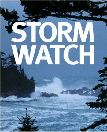
Oregon Braces for Snow, Hurricane Force Winds
Salem-News.comUPDATE: A very light snow shower began in the south and west Salem hills just after 8:45 this morning.
 Salem-News.com |
(PORTLAND, Ore. ) - The National Weather Service in Portland, Oregon has issued a Snow Advisory for the Portland-metro area from noon until 6:00 PM Saturday afternoon.
Snow showers are expected to develop this afternoon, but will mix with rain at lower elevations. The level for sticking snow is expected to be around 500 feet and rise to 1000 feet early Saturday evening. Accumulations of 1 to 2 inches are possible, mainly above 500 feet.
Salem-News.com has had reports since 7:30 AM of light snow falling in the west hills of Portland, Newport, Lincoln City, Otis, and at Spirit Mountain Casino in Grand Ronde. A very light snow shower began in the south and west Salem hills just after 8:45 this morning.
A Snow Advisory means that periods of snow will cause travel diddiculties. Be prepared for snow covered roads and limited visibilities, and use caution while driving.
The City of Portland Office of Transportation is prepared for whatever storm event might occur this weekend -- whether heavy rain, wind, snow, ice, sleet, or slush. The city is advising motorists to be prepared for wet, cold, and windy conditions and to travel accordingly.
City crews have been running anti-icing routes all week to apply calcium magnesium acetate to critical streets, bridges, and overpasses to prevent ice from forming.
Crews will continue to monitor areas all around the city for temperature changes, snow accumulation, and ice, with particular emphasis on known hazard areas in higher elevations on both the west and the east sides of the city.
Oregon Coast Braces for Major Wind Storm:
A High Wind Watch is in effect from Sunday morning through Monday evening for the north and central Oregon coast.
Very strong winds are expected to develop Sunday with wind gusts from 65 to 70 mph. The most ferocious winds will occur late Sunday night and Monday with peak wind gusts of 75 to 80 mph.
A High Wind Watch means there is the potential for a hazardous wind event. Sustained winds of at least 40 mph, or gusts of 58 mph or greater may occur.
Winds in the Willamette Valley could gust to 40-50 mph by Sunday morning.
AVALANCHE WATCH for Mt. Hood Area Sunday and Monday:
With an already unstable snowpack in place, abundant new snowfall mid-late Saturday and Sunday should combine with increasingly strong winds Sunday and a significant warming trend mid-late Sunday into Monday to produce a substantial increase in the avalanche danger both Sunday and Monday.
Although a still relatively shallow snowpack in some areas is helping to limit the avalanche danger presently, significant new snowfall anticipated mid-late Saturday and Sunday should help to cover much of the current terrain and vegetative anchors. Large amounts of increasingly dense wind slab should load and stress a variety of buried weak layers on Sunday.
Consequently, both natural and human triggered slides should become increasingly likely in steeper avalanche terrain, especially on lee slopes above 4 to 5000 feet where a deeper snowcover exists.
Initially, most slides that release should primarily involve only the most recently deposited new snow received late Saturday and early Sunday.
However, with more significant warming and sustained heavy loading likely later Sunday, larger slab slides ranging up to 3 to 5 feet or more should become probable as the increased stresses affect more deeply buried weak layers.
As a result, back country travelers should remain very aware of the significantly increasing avalanche danger over the weekend and into early next week and modify their route selections and trip plans accordingly.
STAY WITH SALEM-NEWS.COM FOR ALL THE LATEST OREGON WINTER STORM WEATHER INFORMATION
Get the seven day forecast for your area Seven Day Weather Forecast Map
Articles for November 30, 2007 | Articles for December 1, 2007 | Articles for December 2, 2007


Quick Links
DINING
Willamette UniversityGoudy Commons Cafe
Dine on the Queen
Willamette Queen Sternwheeler
MUST SEE SALEM
Oregon Capitol ToursCapitol History Gateway
Willamette River Ride
Willamette Queen Sternwheeler
Historic Home Tours:
Deepwood Museum
The Bush House
Gaiety Hollow Garden
AUCTIONS - APPRAISALS
Auction Masters & AppraisalsCONSTRUCTION SERVICES
Roofing and ContractingSheridan, Ore.
ONLINE SHOPPING
Special Occasion DressesAdvertise with Salem-News
Contact:AdSales@Salem-News.com
Terms of Service | Privacy Policy
All comments and messages are approved by people and self promotional links or unacceptable comments are denied.
hi November 17, 2015 10:59 am (Pacific time)
bruh
[Return to Top]©2025 Salem-News.com. All opinions expressed in this article are those of the author and do not necessarily reflect those of Salem-News.com.