Publisher:
Bonnie King
CONTACT:
Newsroom@Salem-news.com
Advertising:
Adsales@Salem-news.com

~Truth~
~Justice~
~Peace~
TJP
Aug-31-2007 08:47

 TweetFollow @OregonNews
Forecast: Western Oregon Cooler, Wetter and Snowier This Winter
Salem-News.comOregon residents east of the Cascades will see warmer-than-average temperatures and average precipitation through the fall and winter.
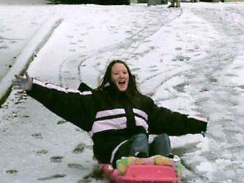
 Snow could be a common sight in Western Oregon and Salem this winter. Photo: Kevin Hays |
(CORVALLIS, Ore. ) - In his years of producing a fall and winter weather forecast for the state, George Taylor has rarely if ever predicted snow for western Oregon – and true to form, he won’t go too far out on a limb this year.
But Taylor, who manages the Oregon Climate Service at Oregon State University, concedes that it is a good likelihood this year.
“The stars are lined up that way,” he said with a laugh.
Taylor and colleague Cadee Hale have just issued the Oregon Climate Service’s forecast for October through March and the bottom line is that once we get through October, temperatures are expected to be slightly cooler than average in western Oregon, with average to above-average precipitation.
And, they say, there is “a good chance” for low-elevation snow in western Oregon.
Oregon residents east of the Cascades, on the other hand, will see warmer-than-average temperatures and average precipitation through the fall and winter.
The brightest forecast may be for skiers and ski resort owners: Snowpack in the Cascade Mountains is expected to be well above-average this year.
“We anticipate a very good ski season,” Taylor said.
One of the reasons for predictions of cooler temperatures and a higher possibility of snow in western Oregon is the development of La Niña-like conditions near the equatorial Pacific.
While it is too early to conclude that a La Niña event will take place this winter, cooler temperatures in the tropical Pacific and stronger trade winds suggest it is a possibility.
La Niña events usually result in cooler, wetter winters for the western portions of the Pacific Northwest.
Every year Taylor makes a prediction for fall and winter weather based on a number of factors, culminating in selecting "analog years" that most closely resemble current conditions.
He takes into account long-term wet and dry cycles (known as the multi-decadal phase), El Niño and La Niña episodes, sea level pressures, temperatures, wind speeds, solar cycles and even hurricanes, which have a surprisingly strong correlation to Northwest climate.
"Based on a composite of analyses, we are usually able to identify four or five analog years that had similar conditions during the first several months of the year, which helps us predict what the weather may be like in the fall and winter," Taylor said.
Taylor and Hale were able to find four analog years with conditions comparable to this winter. Each had some extreme weather events during those years.
• 1952-53 – A major flood hit western Oregon in January, and a major windstorm that same month caused significant damage;
• 1953-54 – A heavy rainstorm fell in western Oregon in November; two strong windstorms followed in December, and three major storms – with wind, rain and snow – struck in January.
• 1970-71 – A major windstorm in March affected the entire state. December was wet with snow in the low elevations. A heavy snowstorm struck the entire state in January, dumping 11 inches of snow in Salem and nine inches in Portland.
• 1988-89 – There was heavy rain with localized flooding in November, followed by an extremely dry month in December. Record low temperatures and heavy snow arrived in February, resulting in five deaths. Central Oregon was hit by flooding in March, the same month a major windstorm killed three people.
It is difficult to predict extreme weather events based on analog years, Taylor pointed out, and there is a possibility of heavy rains, windstorms and even heavy snow.
Three of the four analog years included snowstorms and two of those years had heavy snow, even in western Oregon.
“I will say that there is a good chance of at least one low-elevation snow event,” Taylor said. “And the mountains should see a lot of snow after a slow start. We expect mountain snows to accumulate quickly in November and become significant in January and February.”
The entire forecast and background on how Taylor and Hale arrive at their conclusions is available at the Oregon Climate Service website at: www.ocs.oregonstate.edu
Articles for August 30, 2007 | Articles for August 31, 2007 | Articles for September 1, 2007


Quick Links
DINING
Willamette UniversityGoudy Commons Cafe
Dine on the Queen
Willamette Queen Sternwheeler
MUST SEE SALEM
Oregon Capitol ToursCapitol History Gateway
Willamette River Ride
Willamette Queen Sternwheeler
Historic Home Tours:
Deepwood Museum
The Bush House
Gaiety Hollow Garden
AUCTIONS - APPRAISALS
Auction Masters & AppraisalsCONSTRUCTION SERVICES
Roofing and ContractingSheridan, Ore.
ONLINE SHOPPING
Special Occasion DressesAdvertise with Salem-News
Contact:AdSales@Salem-News.com


googlec507860f6901db00.html
Terms of Service | Privacy Policy
All comments and messages are approved by people and self promotional links or unacceptable comments are denied.
[Return to Top]
©2025 Salem-News.com. All opinions expressed in this article are those of the author and do not necessarily reflect those of Salem-News.com.